

Radio Cadena Agramonte emisiora de Camagüey
![]()

![]()


![]()
![]()
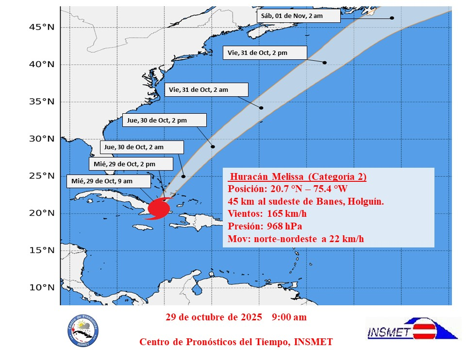
Havana, October 29 - The Institute of Meteorology reported that the central region of Hurricane Melissa has been moving over the province of Holguín for the past three hours, with calm reported in the municipalities of Cueto, Mayarí, and Banes, the latter being the area where it is currently exiting into the sea.
The interaction of this system with the Sierra Maestra mountain range and its movement over the national territory has continued to weaken it. Its maximum sustained winds have decreased to 165 kilometers per hour, with higher gusts, so it is now a Category 2 hurricane on the Saffir-Simpson scale. Its central pressure rose to 968 hectopascals.
At 9:00 a.m., Cuban radar located the center of Hurricane Melissa at 20.7 degrees North latitude and 75.4 degrees West longitude, a position 45 kilometers southeast of Banes, in Holguín province. Melissa continues moving north-northeast at a speed of 22 kilometers per hour.
The areas of rain and thunderstorms associated with this hurricane are affecting eastern Cuba, with some areas experiencing heavy and intense rainfall.
In the last few hours, significant rainfall totals were recorded: 335.2 millimeters at the Holguín Meteorological Center and 268.4 millimeters at the Guaro meteorological station, both in Holguín province.
Rainfall will continue during Melissa's passage with accumulations between 200 and 350 millimeters in the next 24 hours, mainly in mountainous areas, and winds in most of the eastern region will remain at tropical storm force, with speeds between 70 and 119 kilometers per hour, with higher gusts.
So far, a southwest wind gust of 126 kilometers per hour has been reported at the Guaro weather station in Holguín province, and a northeast gust of 110 kilometers per hour in Puerto Padre, Las Tunas province.
Strong swells are expected along both eastern coasts, as well as the northern coast of Camagüey, with waves between 4.0 and 6.0 meters, reaching up to 7.0 meters along the northern coasts of Holguín and Las Tunas provinces. Moderate to severe flooding is expected in low-lying areas along these coasts. As Melissa moves northeast, the wave height and flooding along the southeastern coast will gradually decrease.
The Forecast Center of the Institute of Meteorology is closely monitoring the evolution and future trajectory of this powerful hurricane.
The next tropical cyclone advisory will be issued at 12 noon today. (Text and photo: ACN)