
Radio Cadena Agramonte emisiora de Camagüey
![]()

![]()


![]()
![]()
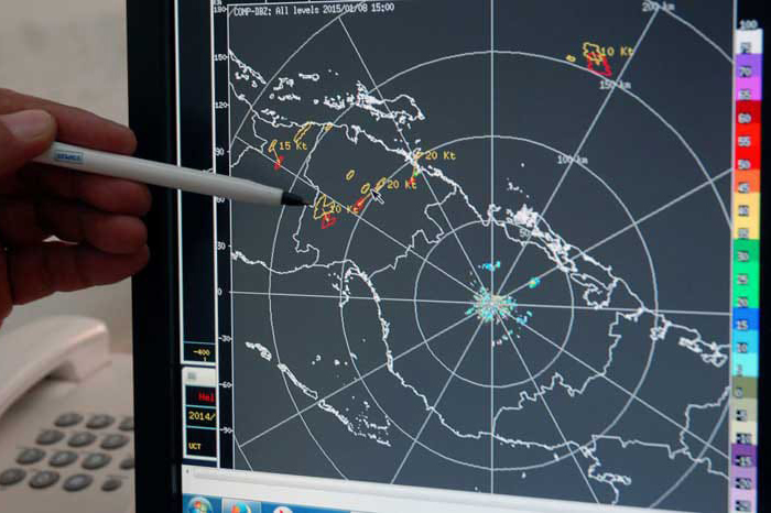
Camaguey, Apr 14th. - Cuba has a network of eight weather radars distributed throughout the archipelago that guarantee the monitoring of the national territory and adjacent maritime areas, despite the limitations caused by the economic, commercial and financial blockade of the United States government to the island.
For more than 50 years, not only in cyclonic season, but also in the face of various events, radars have allowed the incorporation of essential elements into the Early Warning System in the nation, which is possible thanks to the ingenuity, management and extensive experience of specialists in the sector.
In conversation with the Cuban News Agency, Didier Suárez Rodríguez, head of the National Center of Radares, based in this city, highlighted the work of those who today assure that the Antillean nation has 75 percent of its Meteorological Surveillance Service for Radar, in the midst of the restrictions of this policy, which prevents access to necessary spare parts.
The complex financial situation generated in the allocation of foreign exchange required when importing also has an impact, Suárez Rodríguez said.
The largest island in the Caribbean, historically vulnerable to cyclones, is committed to its network of weather radars to deal with more intense phenomena, based on the effects of climate change and lessons from past organisms.
That is why this system is already preparing, for the coming season, in terms of radar surveillance with that of the Atlantic 2024, still fresh in memory, after the impact of Hurricane Rafael in the western region, and tropical storm Oscar at Guantanamo, remarked.
The infrastructure in this area, managed by the Institute of Meteorology and entrusted to the Radares Center, located in Camaguey, is key for both the Cuban Civil Defense and the region in which the country is located, as its data are shared with international organizations and the National Hurricane Center of the United States.
The radars provide, he said, once the cyclones enter into their measurement range, more accurate data to complement the reports obtained through satellite images, numerical models and other tools, and predict the point where the eye will touch earthly.
The national center also enlists the computer infrastructure that sustains the entire system and allows the processing of information in the usual commented images offered by the media, and digital, in the profiles on social networks Facebook and X. (Jorge Luis Moreira Massagué /ACN) (Photo: Rodolfo Blanco Cué/ ACN)