
Radio Cadena Agramonte emisiora de Camagüey
![]()

![]()


![]()
![]()
Havana, August 15.- The Forecast Center of the Cuban Institute of Meteorology (Insmet, for its acronym in Spanish) reported today that Erin has reached hurricane status in the waters of the tropical Atlantic Ocean, becoming the first of the current hurricane season.
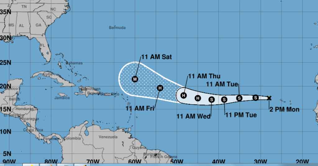
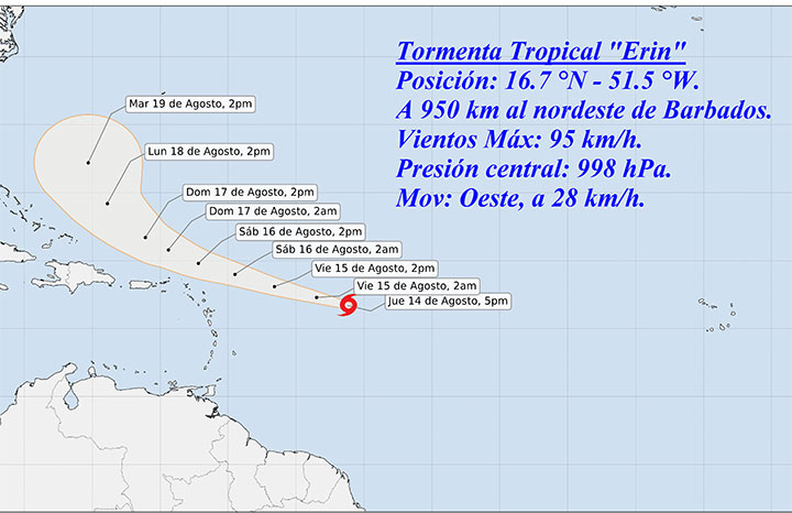
According to the Tropical Cyclone Warning No.6, issued at 11:00 a.m., Erin has sustained maximum winds of 120 kilometers per hour (km/h) and a central pressure of 996 hectoPascal, making it a category one hurricane on the Saffir-Simpson scale of a maximum of five.
At that time, the meteorological phenomenon was located at 18.2 degrees North latitude and 56.1 degrees West longitude, approximately 740 kilometers east of the northern group of the Lesser Antilles; it is moving west-northwest at a speed of 30 km/h.
The Warning clarifies that although the cyclone does not currently pose a threat to Cuba, INSMET is closely monitoring its evolution and future trajectory.
Erin is expected to maintain a similar path and speed over the next 12 to 24 hours and continue to rapidly gain in intensity.
The next tropical cyclone warning for this hurricane will be issued at 6:00 p.m. today. (Source: ACN)